DesignSafe-CI Accelerates the "Resilience Curve"
Published on February 12, 2019
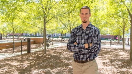
David Roueche is a wind engineer and assistant professor of Civil Engineering at Auburn University.
Platform proves valuable for post-disaster data gathering
By Aaron Dubrow, Texas Advanced Computing Center
According to David Roueche, wind engineer and assistant professor of Civil Engineering at Auburn University, the 2017 and 2018 hurricane seasons put the NSF-funded DesignSafe platform to the test and it shows great promise.
Roueche was on the front lines of the hurricane response during these particularly active seasons, participating in reconnaissance missions to coastal Texas, the Florida Keys, the Florida panhandle, coastal North Carolina, Puerto Rico and several Caribbean islands in the wake of Hurricanes Harvey, Irma and Maria in 2017 and Hurricanes Florence and Michael in 2018.
David Roueches team imported data directly from DesignSafes Data Depot into Hazmapper, a tool that facilitates data visualization, processing and analysis.
After Harvey (2017), Roueche and his collaborators targeted clusters of single-family homes impacted by a range of wind speeds. They inspected more than 1,000 individual homes and logged more than 5,000 geotagged photographs captured by ground-based teams and unmanned aerial vehicles. They participated in similar efforts after Irma (2017) and Maria (2017).
These efforts served as the foundation for the new Structural Extreme Events Reconnaissanace (StEER) network, which was founded through an NSF EAGER grant (PI Tracy Kijewski-Correa at the University of Notre Dame) to build societal resilience by generating new knowledge on the performance of the built environment through impactful post-disaster reconnaissance disseminated to affected communities. StEER has relied upon the same tools and methods used in the 2017 hurricane season in responses to Hurricanes Florence (2018) and Michael (2018) and is expanding the approach to encompass structural impacts from all hazards.
DesignSafe helped researchers in a variety of ways. Researchers coordinated their deployments via virtual community channels on Slack (a cloud-based collaboration tool) established by DesignSafe; they used wind-map data developed by other researchers and shared on DesignSafe to determine where they would focus their efforts; and once they began capturing data in the field, they uploaded it immediately to DesignSafe and used mapping and visualization software like HazMapper and QGIS to generate maps that synthesized their and others data collections.
We were interested in capturing data about structures before theyre destroyed, torn down and rebuilt, Roueche said. This is perishable data thats the purpose of the NSF RAPID program to capture this perishable data before its lost.
Roueche and his team found examples of houses side-by-side, built around the same time, where one was completely destroyed, and the other was intact. What factors influenced survival? And how could rebuilding efforts be improved by understanding what features led some structures to stand up to storms?
DesignSafes integrated workflow accelerates the resilience curve so recommendations from natural hazard engineers can be disseminated in months rather than years.
DesignSafes Reconnaissance Portal, which launched in 2017, provided both the computing capabilities Roueche needed for his analyses and a place to share more than 200 gigabytes of gathered data. The portal also allowed his team to immediately begin quality control and assessments on the data and rapidly generate reports that others going into the field later could use and contribute to.
Typically, it takes years for data gathered by researchers after a storm to be analyzed and reported on, which means rebuilding efforts cannot take advantage of engineers insights. With a system like DesignSafe, however, there is hope that the resilience curve can be accelerated and that recommendations can be disseminated in months.
We want cities to be able to rebuild more resiliently, Roueche said. It can be one to five years before products from post-disaster data are out in literature. That doesnt allow us to help communities in rebuilding. By having a more streamlined workflow, standardizing processes, and publishing data and data products sooner, it allows us to affect the reconstruction process and have a greater impact. Thats why Im super excited about where this is going.
Roueches collaborators included the following: Frank Lombardo from University of Illinois at Urbana-Champaign, Richard Krupar III from Berkshire Hathaway Specialty Insurance, Daniel Smith from the Cyclone Testing Station at James Cook University, and Tracy Kijewski-Correa from the University of Notre Dame.