


FOR IMMEDIATE RELEASE:
NSF-supported Natural Hazards Cyberinfrastructure Provides Tools, Data, Education
DesignSafe Cyberinfrastructure (www.designsafe-ci.org)
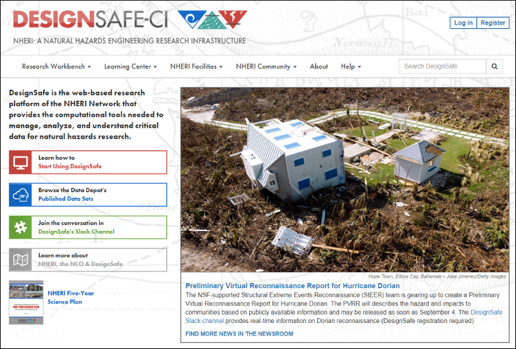
AUSTIN, Nov. 9, 2019 Securing the built environment against natural hazards requires serious technical sophistication. DesignSafe, the cyberinfrastructure component of NSFs Natural Hazards Engineering Research Infrastructure (NHERI), provides a robust platform for researchers building on new ideas. With over 4,000 users and 10 TB of data, the platform embraces a cloud strategy for managing big data, the mountains of information generated by natural hazards engineering and social science researchers.
Supporting natural hazards research since 2016, the DesignSafe team continues to upgrade and update the platform aiming to be the system of choice for engineering ways to mitigate damage from events such as earthquakes, hurricanes and tornados, storm surge and tsunamis.
Our vision is to enable transformative research that integrates experimental and field data, computational simulation, and large-scale data analytics to ensure our infrastructure and communities are safe from natural hazards, said Ellen Rathje, principal investigator for the DesignSafe Cyberinfrastructure.
The latest tools
DesignSafe provides the latest software tools. For example, OpenSees, ADCIRC, OpenFOAM, LS-Dyna, LS-PrePost and Matlab 2019b are all available in the Workspace. Other tools are available that span all natural hazard domains and support computational simulation, data analysis and visualization. OpenSees pre/post-processors STKO and GiD are coming soon.
Researcher Erica Fischer, assistant professor of civil and construction engineering at Oregon State University, leverages DesignSafes numerical models. Such access is necessary to perform simulations of laboratory tests or community-level performance, she said. Without that data to benchmark numerical modeling techniques, simulations are simply not possible. Sharing of laboratory testing data is crucial; it allows other researchers to build off of laboratory tests to investigate the influence of other parameters, Fischer added.
Published datasets
Researchers regularly add new datasets to DesignSafe. Recently published datasets include 3D digital elevation models (DEM) of fault rupture from the 2019 Ridgecrest earthquake, reconnaissance reports from Hurricane Dorian and concrete wall tests from the University of Auckland. Users can browse or search the Data Depot, and field reconnaissance data can also be accessed via the Reconnaissance Portal.
Through DesignSafe, we make natural hazards engineering data available for the world to see, said Maria Esteva, DesignSafe data archivist. The DataDepot is where research peers can come to find, preview, and reuse data so that they can enhance their knowledge about whats being done in NHERIs experimental facilities.
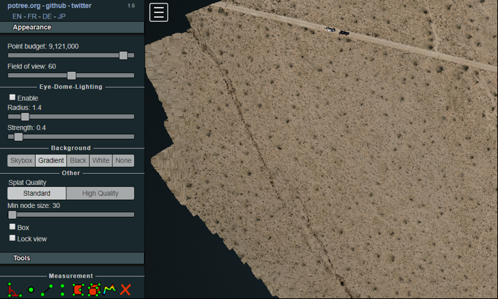
Published 3D Digital Elevation Model (DEM) of fault ruptures from the 2019 Ridgecrest Earthquake.
Field research support
In DesignSafes Data Depot, a newly added field research data model gives researchers the much-needed ability to organize and publish the field reconnaissance data that is collected to understand the impact of natural hazard events. This data model complements existing data models for experiments, simulation, hybrid simulation and other data types. Soon, the field research data model will support social science data, a key element in multidisciplinary natural hazards investigations.
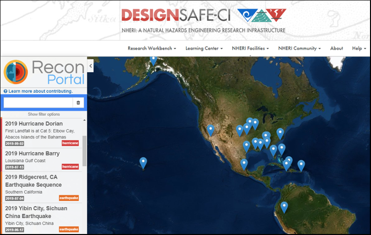
View of DesignSafe's Reconaissance Portal
Community learning
DesignSafes Learning Center hosts an ongoing series of webinars for learning about natural hazards research from software tutorials to research case studies. Tutorials are archived on the DesignSafe YouTube channel. Be sure to view our recent and upcoming webinars:
- October 28: Leveraging Python, Jupyter Notebooks, DesignSafe, and the SimCenter Educational Tools in the Classroom (Barb Simpson, Oregon States)
- November 13: End to End Multi-Threat Fragility Modeling using DesignSafe (S. Kameshwar, LSU)
- November 18: Introduction to STKO: The Scientific ToolKit for OpenSees (G. Camata, M. Petracca, ADSEA Inc.)
Ellen Rathje and others from the DesignSafe team will be at the NHERI booth during the AGU Fall Meeting, held December 9-13 in San Francisco. They urge everyone to drop by to discuss how NHERI and DesignSafe can enhance their natural hazards research projects.
About the NHERI network. The Natural Hazards Engineering Research Infrastructure (NHERI) is a distributed, multi-user, national facility that provides the natural hazards engineering community with state-of-the-art research infrastructure. Funded by the National Science Foundation, NHERI enables researchers to explore and test ground-breaking concepts to protect homes, businesses, and infrastructure lifelines from the impacts of earthquake, wind, and water hazards, enabling innovations to help prevent natural hazards from becoming societal disasters.
The research infrastructure includes earthquake and wind engineering experimental facilities, cyberinfrastructure, computational modeling and simulation tools, social science resources, research data, and expert personnel. When coupled with training and mentoring initiatives and community outreach, NHERI facilitates research and educational advances that contribute knowledge and innovation toward improving the resiliency of the nations civil infrastructure to withstand natural hazards.
Media contacts:
PI, DesignSafe Cyberinfrastructure
Janet S. Cockrell Centennial Chair in Engineering
University of Texas at Austin
e.rathje@mail.utexas.edu