


When Extreme Events Strike
A snapshot of work underway by NHERI teams during Hurricane Ian's landfall
Published on September 29, 2022
When natural hazards strike, researchers around the NHERI network spring into action eager to do what they do best: document extreme events and their damage with imagery and data in hopes of preventing similar destruction in the future. When it comes to hurricanes, teams spend the days prior to landfall preparing for possible to deployment: watching the storms progress, communicating with fellow storm-watchers, organizing transportation, packing specialized gear.
According to CBS News, Hurricane Ian made landfall on Floridas Gulf Coast as a powerful Category 4 storm just a few miles per hour shy of a Category 5. Ian hit with high winds and catastrophic storm surge in cities like Naples and Fort Myers. The storm is expected to wreak more havoc as it crosses the Florida peninsula and moves up the Atlantic coast to North Carolina.
Below is a mere snapshot of the work underway around the NHERI network as of Wednesday, Sept. 28.
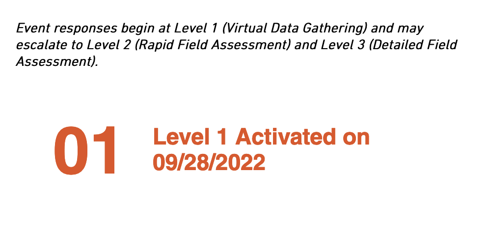
Structural Extreme Event Reconnaissance group
The StEER team has activated its network in response to Hurricane Ian at Level 1 with a Virtual Assessment Structural Team (VAST) formed to assemble available data for a Preliminary Virtual Reconnaissance Report (PVRR), which will inform about possible escalation of the response to a full Field Assessment Structural Team (FAST).
Individuals seeking to stay current are welcome to consult the StEER response page or the #steer channel on NHERIs Slack. Other Extreme Event groups, including SUMMEER, are considering their response to this Category 4 storm.
The NHERI RAPID
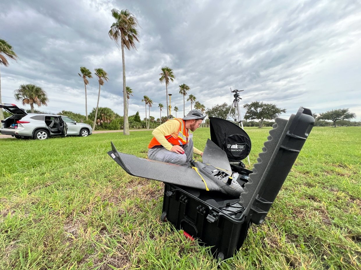
Jaqueline Zdebski and Andrew Lyda from the RAPID facility used UAVs to survey Cedar Key and De Soto Park to determine pre-storm conditions before Hurricane Ian impact, work done for researchers with NEER, the Nearshore Extreme Event Reconnaissance group.
Right, the RAPIDs Andew Lyda with the SenseFly Ebee X, a fixed wing drone used to create orthomosaics and 3D maps of large areas.
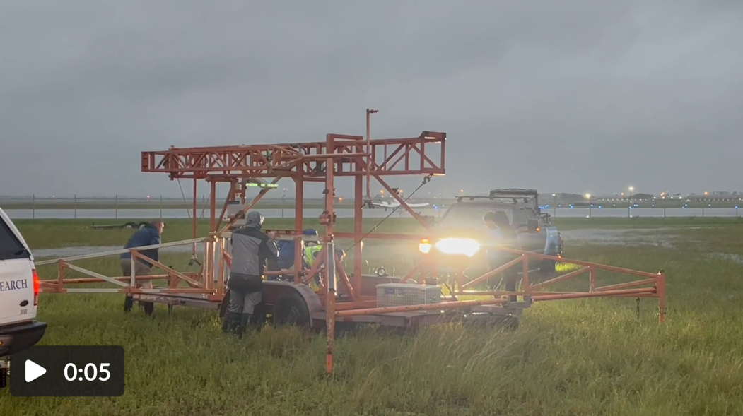
University of Florida
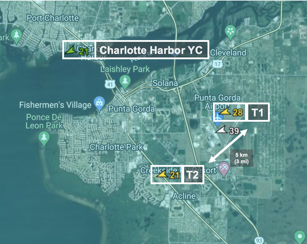
UFs Forrest Masters and his team set up mobile weather stations at Punta Gorda, near the airport. The resulting data will provide a record of wind speeds that will help when studying damage to local building stock.
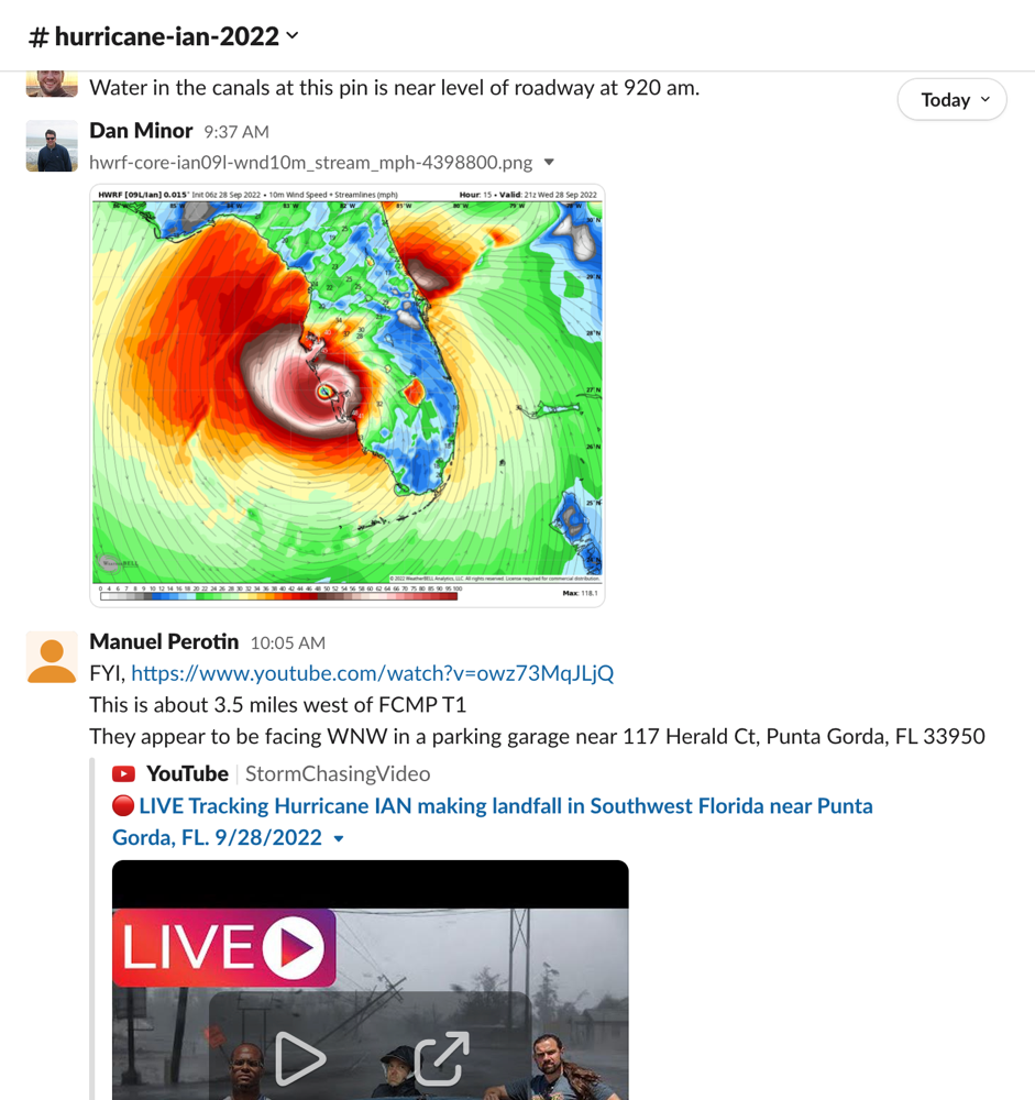
NHERI DesignSafe Slack Channel
This online communication resource enables stormwatchers, researchers and reconnaissance teams to exchange real-time data, locations, and imagery. At present, 152 individuals and groups are monitoring Ian via the #hurricane-ian-2022 Slack channel. The channel is open to all NHERI users. Get details about Slack access here.
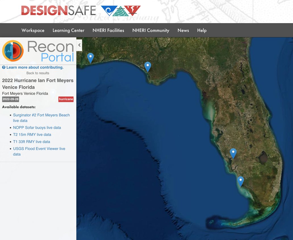
DesignSafe Reconnaissance Portal
As well as hosting the Slack channel, the DesignSafe team is already making Hurricane Ian data available on the DesignSafe ReconPortal.
NHERI on Twitter
During extreme events, many NHERI affiliated Twitter accounts provide current information. Look to @NHERIDesignSafe for posts from extreme events researchers and organizations.