NHERI RAPID Helps Preserve Sensitive NJ Wetlands
Published on December 1, 2022
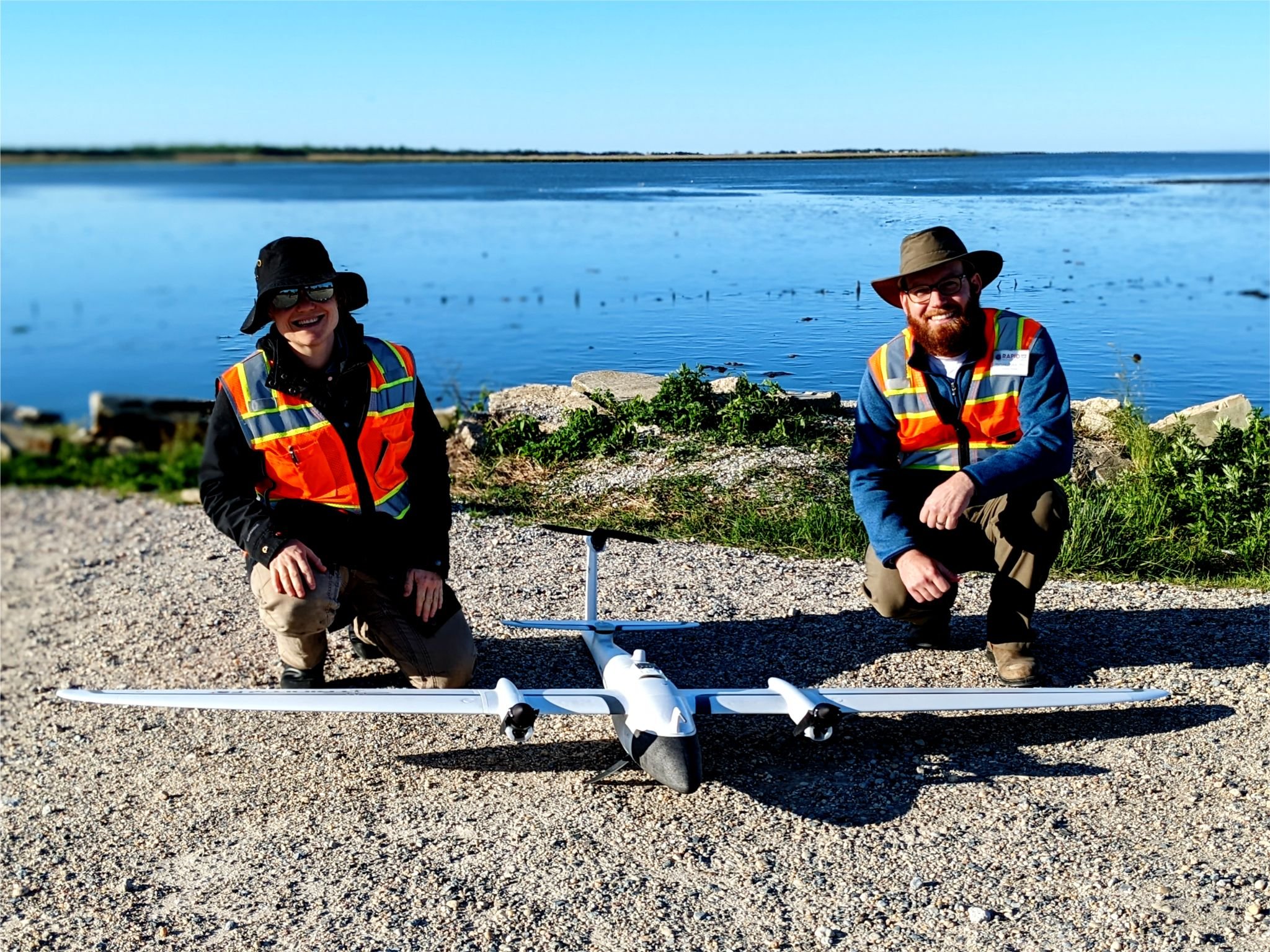
The NHERI RAPID and the US Army Engineer Research and Development Center (ERDC) flew the Trinity F90 UAV during a recent wetland mapping project in New Jersey. Dr. Brian Harris of ERDCs Coastal and Hydraulics Laboratory (CHL) explains that the implementation of drones is critical to map these wetland nourishments, which are notoriously difficult to survey with traditional methods.
Wetland areas can be too expansive for terrestrial LiDAR, and the ground is too soft for manual RTK-GPS surveys. In addition, this particular sites elevation is so low in the tidal range that it is only exposed for an hour during each tidal cycle, inhibiting satellite-based methods. Onsite were the RAPIDs Jaqueline Zebski (left) and Dr. Michael Grilliot.
This drone was also used to capture next-generation oblique imagery over seven square miles of post-Hurricane-Ian impacted Fort Meyers, FL. Read more about RAPID projects at the facility website.